
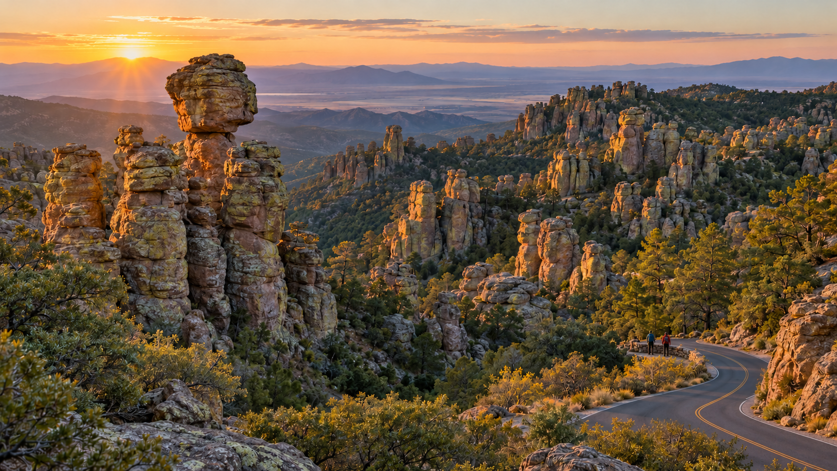
Chiricahua National Monument became Chiricahua National Park on October 20, 2026, when the Chiricahua National Park Act was signed into law. The redesignation makes the 12,000-acre ‘Wonderland of Rocks’ in southeastern Arizona the United States’ newest national park and Arizona’s fourth, joining Grand Canyon, Petrified Forest and Saguaro.
For travelers, the immediate change is smaller than the new title suggests. The boundary did not expand, the National Park Service says hiking, camping and scenic driving will continue, and the same narrow roads, remote setting and limited services still shape a visit. The biggest near-term effect may be attention: more people will now add Chiricahua to national-park lists, making advance planning more important at a park with small trailhead lots and just 23 reservable campsites.
Chiricahua National Park at a glance
- New status: redesignated from national monument to national park on October 20, 2026.
- Location: southeastern Arizona near Willcox, about 120 road miles east of Tucson.
- Landscape: rhyolite pinnacles, balanced rocks, canyons and sky-island forest formed after volcanic activity roughly 27 million years ago.
- Main experiences: Bonita Canyon Scenic Drive, Massai Point, Echo Canyon, hiking, birding, historic Faraway Ranch and dark-sky viewing.
- Current entrance charge: no park entrance fee; camping and some reservations still cost money.
- Campground: Bonita Canyon has 23 sites, all by reservation, with no hookups, showers or dump station.
- Connectivity: cell service is rare; download maps and essential information before leaving Willcox or Sunizona.
What the national park designation changes
The October 20 law changes the unit’s name and recognizes the national significance of its geology, biodiversity and cultural history. The National Park Service and Department of the Interior describe the redesignation as a new chapter for an area first protected as a national monument in 1924. It also raises Chiricahua’s profile within the best-known group of National Park Service sites.
The practical impact is likely to emerge over time. National park status can increase search interest, road-trip traffic and demand for nearby lodging. That matters here because the park has one paved entrance, one small campground and compact parking areas at major trailheads. A quiet weekday can still feel spacious, but holiday, spring-break and mild-weather weekends may fill earlier as awareness grows.
The law does not create a new park out of unprotected land. The same landscape was already managed by the National Park Service, and the Interior Department says the park will continue offering the same core activities. Travelers should not assume the new label guarantees new hotels, restaurants, transit, parking or cellular coverage.
What does not change for visitors
- The existing park boundary and approximately 12,000 protected acres remain the starting point for a visit.
- Bonita Canyon Drive remains a narrow, winding road with strict vehicle-length limits.
- Private vehicles remain the practical way to reach the park; rideshare and taxi service are not dependable nearby.
- Food, fuel, ice, charging and most supplies are outside the park, generally 30 to 40 miles away in Willcox or Sunizona.
- Weather, fire restrictions, trail conditions and temporary facility closures can still change daily plans.
- Cultural resources and the park’s importance to the Chiricahua Apache require the same respect as the scenery.
The best first visit: Massai Point and Echo Canyon
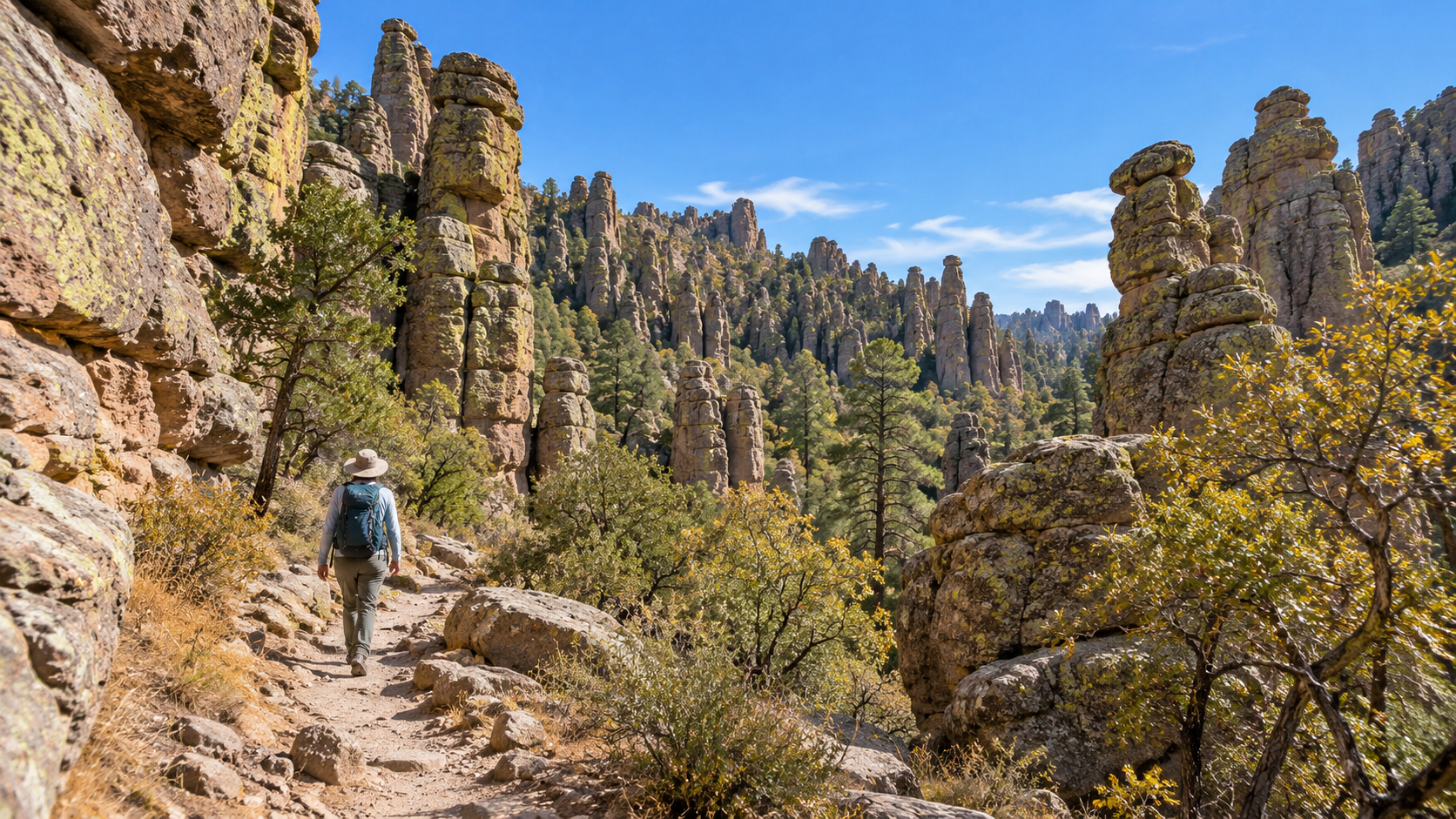
A first visit works best when it combines the eight-mile Bonita Canyon Scenic Drive with one trail suited to the group. The road ends at Massai Point, where broad views reveal how the rock pinnacles rise from forested slopes above the desert basin. Short interpretive walking and picnic opportunities make the overlook useful even for visitors who do not plan a long hike.
Echo Canyon provides the classic walk-between-the-rocks experience. Trail length depends on the chosen route, so use the current NPS hiking guide rather than a screenshot or an old blog description. The terrain includes uneven stone, stairs, steep grades and exposed edges. Start with a shorter option if anyone is adjusting to elevation, and carry more water than the cool-looking pine-and-oak scenery might suggest.
Parking at Echo Canyon, Sugarloaf and other upper-road trailheads is limited. Arrive early, avoid blocking turnarounds and have a legal fallback such as Massai Point or a lower-elevation walk. There is no guarantee that national park status will immediately add parking capacity.
A realistic one-day plan
- Arrive with a full fuel tank, downloaded map, water, food and layers before the visitor center opens.
- Stop at the visitor center for current trail, weather, fire and program information.
- Drive first to the upper trailhead or Massai Point while parking is available.
- Choose one primary hike, then save Faraway Ranch or a short nature trail for the return drive.
- Leave enough daylight for the winding descent and avoid driving unfamiliar unpaved approaches after dark.
Road and vehicle limits can change the entire plan
The paved approach from Willcox follows Interstate 10 to Highway 186, then Highway 181. From Sunizona, Highway 181 reaches the same single park entrance. NPS warns that Pinery Canyon Road and Apache Pass are winding, rocky dirt roads that can become impassable after rain or snow; a navigation app’s shortcut should not replace the paved route for an ordinary rental car.
Vehicles and trailers longer than 29 feet must stop at Faraway Ranch, and vehicles longer than 24 feet are not allowed beyond the campground on the upper scenic drive. Even some legal-size vehicles may struggle with low branches, tight parking or unlevel campground approaches. Large-RV travelers should consider leaving the rig in Willcox or Sunizona and using a smaller vehicle.
The paved park road ends at Massai Point; it is not a through-route across the Chiricahua Mountains. Download an offline map, fuel or charge before turning onto Highways 186 and 181, and do not count on a last-minute rideshare if the car becomes unusable.
Camping requires a reservation and self-sufficiency
Bonita Canyon Campground is open year-round and contains 23 sites, all reserved through Recreation.gov. The NPS says the campground often fills during holidays, October and January through April. There are flush toilets, potable water, picnic tables and food lockers, but no electrical hookups, showers, dump station, camp store, ice or firewood sales.
Standard sites are listed at $25 per night and the tent-only group site at $50, subject to change. The road dip and tree cover impose a 29-foot maximum vehicle or trailer length, while individual sites may be shorter or harder to enter. Read the dimensions and full description of the exact campsite before booking.
Cell reception and campground internet are absent. Bring food, water containers, approved cooking equipment and current fire-restriction information. Nights at roughly 5,400 feet can be cold even when lower-elevation Arizona feels warm; the park rises above 7,000 feet and higher areas may be cooler and windier.
Weather, elevation and safety deserve desert-level planning
Chiricahua is a sky island, not a flat low-desert park. Summer heat, monsoon thunderstorms, winter snow, cold nights and rapid elevation changes can all affect a trip. NPS advises hikers to carry water and electrolytes, sun protection, salty snacks and appropriate footwear, and to allow time to adjust to thinner air.
Start early, turn back before fatigue becomes a navigation problem and keep wildlife at a distance. Bicycles and e-bikes are not permitted on park trails. Pets, fire, camping and food-storage rules vary by location, so check the current park alerts and the superintendent’s rules before arrival rather than relying on a guide written for the former monument.
Accessibility and low-impact options
Travelers who cannot use steep trails can still experience the park through scenic pullouts, Massai Point, the visitor center area and the ADA-accessible Bonita Creek Trail. The NPS identifies campsite 8 as accessible and asks visitors seeking specific accommodations to contact the park in advance.
Conditions can change the usefulness of any one stop. Confirm restroom, trail-surface, parking and exhibit access shortly before the trip. A companion should never park in a roadway or create a new pullout to shorten the walk.
A verified map option—and a free official alternative
Amazon lists Chiricahua National Monument Map: Guide to Hiking and Camping at Chiricahua National Monument by Anthony Brown (ASIN B0D7QH6J23). Its title uses the former designation because it predates the October 2026 name change. Treat any commercial guide as a supplement, verify its publication details and compare every route with current NPS information.
Check the Chiricahua map and hiking guide on Amazon (ASIN B0D7QH6J23). Confirm the author, format, edition, seller and return terms before ordering.
The NPS also provides a free printable park map and hiking guide. Download those official files for the latest agency routes and carry a paper copy because mobile reception is unreliable.
Disclosure: ReaderSpice may earn a commission from qualifying Amazon purchases made through the link above, at no additional cost to you.
Planning checklist
- Check the NPS alerts, weather and fire restrictions on the morning of travel.
- Download the official park map and hiking guide for offline use.
- Confirm vehicle length and parking limits before bringing an RV or trailer.
- Reserve Bonita Canyon Campground; do not expect walk-in campsites.
- Fill the fuel tank or charge the vehicle and buy food, water and ice before the final approach.
- Choose a primary trail and at least one lower-effort alternative.
- Respect closures, cultural sites, wildlife and Leave No Trace principles.
The bottom line
Chiricahua’s new national park title is significant, but a visit still depends on the realities of a small, remote mountain park. The rock spires, scenic drive, trails and campground are not newly created attractions; they are the same resources the National Park Service has protected for more than a century under a more prominent name.
Plan for increased interest without assuming expanded services. Arrive early, use the official map, respect vehicle limits, reserve camping and bring what you need from town. That preparation leaves more time for the reason to go: walking among one of the Southwest’s most unusual volcanic landscapes.
Sources
National Park Service: Official redesignation announcement
National Park Service: Directions, paved approaches and vehicle limits
National Park Service: Hiking guidance and safety
National Park Service: Bonita Canyon Campground reservations, facilities and fees
National Park Service: Free printable park maps and hiking guide
Amazon: Chiricahua map and hiking guide (ASIN B0D7QH6J23)