
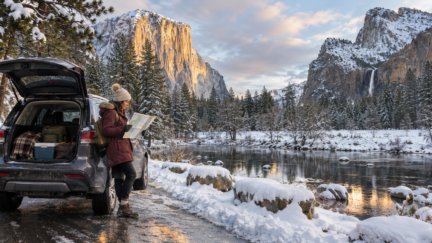
Yosemite is entering its winter travel pattern. On November 12, 2026, the National Park Service temporarily closed Tioga Road and Glacier Point Road because snow was forecast, while Yosemite Valley, Wawona and the park’s western entrances remained the practical focus for most visitors. Those alerts can change quickly, and a temporary closure in November is not automatically the same thing as a confirmed season-long closure.
A winter trip can still be rewarding, but it needs a different route plan from a summer visit. Tioga Road usually closes from sometime in November until late May or June, the road to Glacier Point usually closes over the same broad period, tire chains can become mandatory on any vehicle, and the Mariposa Grove shuttle stops when weather ends the operating season. Holiday weekends and the February Horsetail Fall period can also bring traffic and limited parking even when the rest of winter is quiet.
This guide separates the current November alert from the park’s normal winter pattern and explains what to check before departure. Conditions, chain controls, services and shuttle schedules can change after publication, so the National Park Service current-conditions page and the recorded road line remain the final checks for a specific travel day.
Yosemite winter travel at a glance
- Current alert: Tioga Road and Glacier Point Road were temporarily closed on November 12 because of forecast snow. Check again before driving; do not assume the status is unchanged.
- Year-round access: Yosemite Valley, Wawona, Crane Flat and Hetch Hetchy are generally reachable by road in winter, although weather, chain controls and temporary closures still apply.
- East-side warning: when Tioga Road is closed, there is no direct drive through the park between Yosemite Valley and Lee Vining, Mammoth Lakes, Death Valley or Las Vegas.
- Chain rule: carry correctly sized tire chains or cables from November through March and know how to install them, even with all-wheel drive or four-wheel drive.
- Lower-elevation option: Highway 140 through El Portal generally receives chain controls less often than Highways 41 and 120, but it is not guaranteed to be chain-free.
- Mariposa Grove: the 2026 shuttle is scheduled to run through November 30 only when weather permits; after service stops, expect a two-mile approach each way with about 500 feet of climbing.
- Badger Pass: the first part of Glacier Point Road is normally plowed to the ski area from roughly mid-December through March when the area is operating.
- Reservations: a general winter trip may not require a seasonal vehicle reservation, but lodging, campgrounds, activities and special-event entry can still require advance booking.
Plan for tire chains and rapidly changing road status
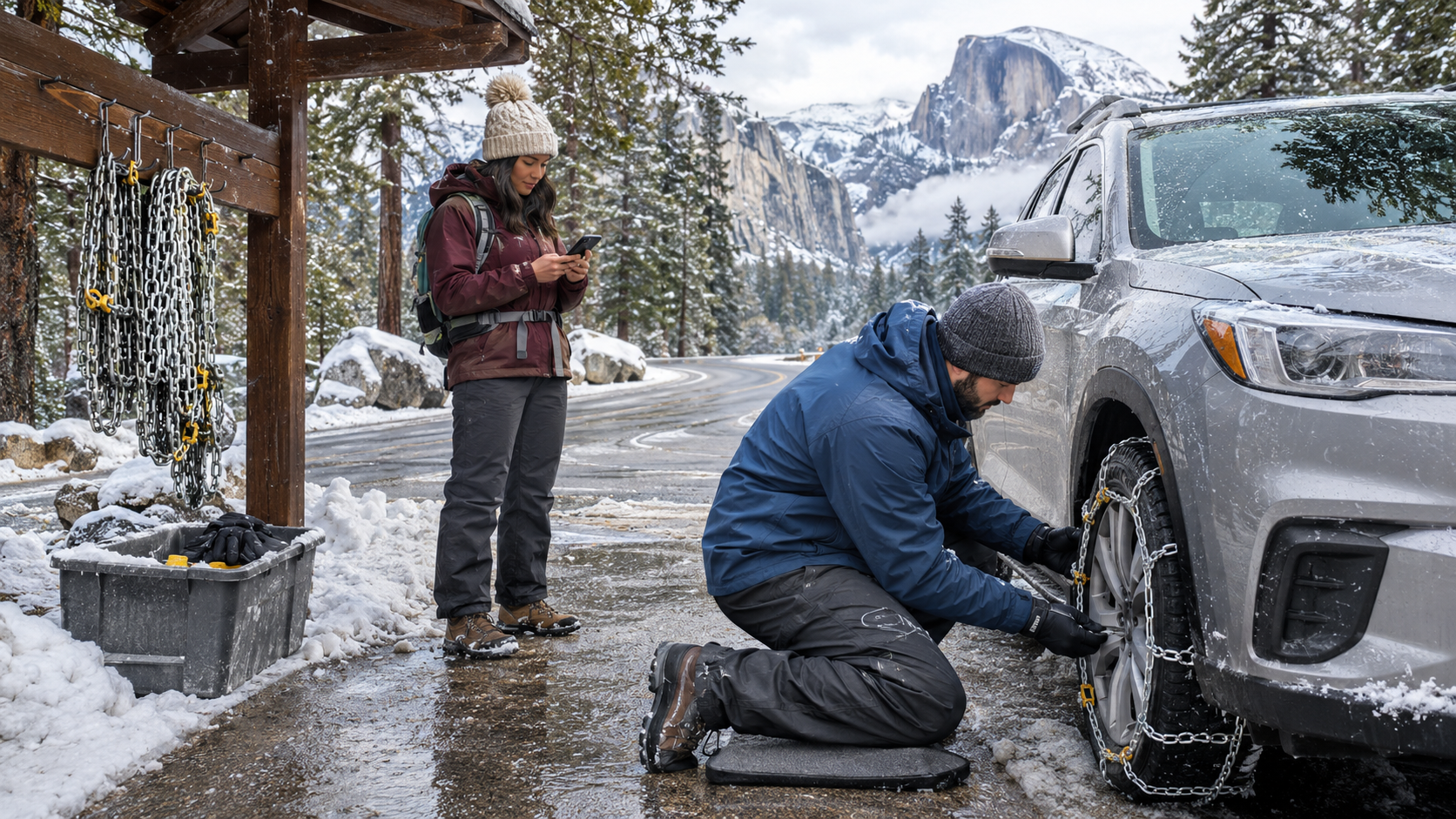
Two prepared travelers install tire chains at a designated pullout beside a snowy mountain road near Yosemite.
Chain controls are a legal and practical part of Yosemite winter driving. The National Park Service says all vehicles must carry chains when controls are in effect, including four-wheel-drive, all-wheel-drive and rental vehicles. A drivetrain can help a vehicle move, but it does not eliminate braking and steering limits on snow and ice. Park staff can require chains on any vehicle when conditions warrant.
Buy or rent chains that match the exact tire size printed on the sidewall, confirm that the vehicle manufacturer permits their use, and practice installation on dry ground. Some vehicles require low-clearance cables or prohibit chains on a particular axle. Rental policies vary, so ask the rental company in writing whether chains may be carried and installed. Do not discover a clearance problem in a snowy turnout after controls begin.
Check conditions close to departure, then check again before the last reliable fuel and service stop. For roads inside Yosemite, call 209-372-0200 and press 1, then 1. For California highways outside the park, use Caltrans QuickMap or call 800-427-7623. If a storm intensifies, an open road can close or move to a stricter chain-control level with little warning.
- Carry waterproof gloves, a kneeling pad or old floor mat, a headlamp and a compact bag for wet chains.
- Use a designated safe pullout or chain-control area; never stop in a live traffic lane or on a blind curve.
- Install the traction device on the correct drive axle, follow its speed limit and recheck tension after a short distance.
- Leave extra following distance, brake early and avoid cruise control on snow, ice or slush.
- If conditions exceed the driver’s experience or the vehicle’s capability, turn around or wait. A reservation is not a reason to continue unsafely.
Understand the two high-elevation road closures
Tioga Road is Highway 120 across Yosemite’s high country. When it closes between Crane Flat and Tioga Pass, visitors cannot drive to Tuolumne Meadows or enter from the eastern Sierra. The National Park Service says the usual closure lasts from sometime in November until late May or early June. Highways 108 and 4 across the Sierra are normally closed in winter as well, so the detour is not a short loop around the park.
Glacier Point Road also normally closes from sometime in November until late May or early June. It is not possible to drive to Glacier Point during that closure. From about mid-December through March, the first five miles are typically plowed to Badger Pass Ski Area when conditions and operations allow. The open ski-area segment should not be mistaken for access to Glacier Point.
The November 12 notice described both roads as temporarily closed because of forecast snow. In late fall, roads can reopen after a storm and then close again, or a temporary closure can become the seasonal closure. Use the park’s live status and phone recording instead of relying on a map app, an old social post or a cached search result.
Choose the right winter entrance and route
Most winter visitors approach from the west. Highway 140 follows the Merced River through El Portal and stays at a lower elevation than the other main approaches, so the park says it has chain requirements less often. Highway 41 reaches the South Entrance and Wawona, while Highway 120 from the west reaches the Big Oak Flat Entrance. All can experience snow, ice, rockfall, roadwork or chain controls.
A traveler starting east of the Sierra must plan around the Tioga closure. The park’s published winter-route examples put Lee Vining and Mono Lake at roughly 390 to 410 miles and about eight hours from Yosemite via northern passes, Death Valley at about 450 miles and nine hours via Bakersfield, and Las Vegas at about 495 miles and eight to ten hours. Those are planning estimates, not promises; storms and traffic can add time.
Build the itinerary around daylight, fuel availability and a realistic arrival window. Download maps and lodging details before entering areas with weak service. If driving after a storm, ask the lodging property which approach staff are currently using and whether parking has been plowed, but still verify the answer against official road controls.
What remains accessible in winter
Yosemite Valley and Wawona remain the core year-round areas. Valley roads, the visitor area, many lower-elevation paths, lodging and some food services can remain available, but hours are reduced compared with summer. Hetch Hetchy Road is generally open during daylight and can close when snow is falling or forecast overnight. Weather and hazards can temporarily affect any road or trail.
Winter is not guaranteed to mean deep snow on the Valley floor. The National Park Service lists typical winter conditions near Yosemite Valley and Wawona around a 53°F high and 28°F low, while higher areas hold snow more consistently. Rain, wet snow, black ice and rapid temperature changes are all possible. Waterfalls may begin flowing again after rain and snow, but they are usually far below spring volume.
Some Valley trails stay usable, yet an open trail is not necessarily a dry or easy trail. Shaded sections can hold ice after sunny pavement has melted. The Mist Trail, Four Mile Trail and higher routes can have seasonal closures or hazardous conditions. Ask a ranger about the intended route on the day of the hike, turn around when traction or navigation becomes uncertain, and keep a low-elevation alternative.
Reach Mariposa Grove after the winter shuttle stops
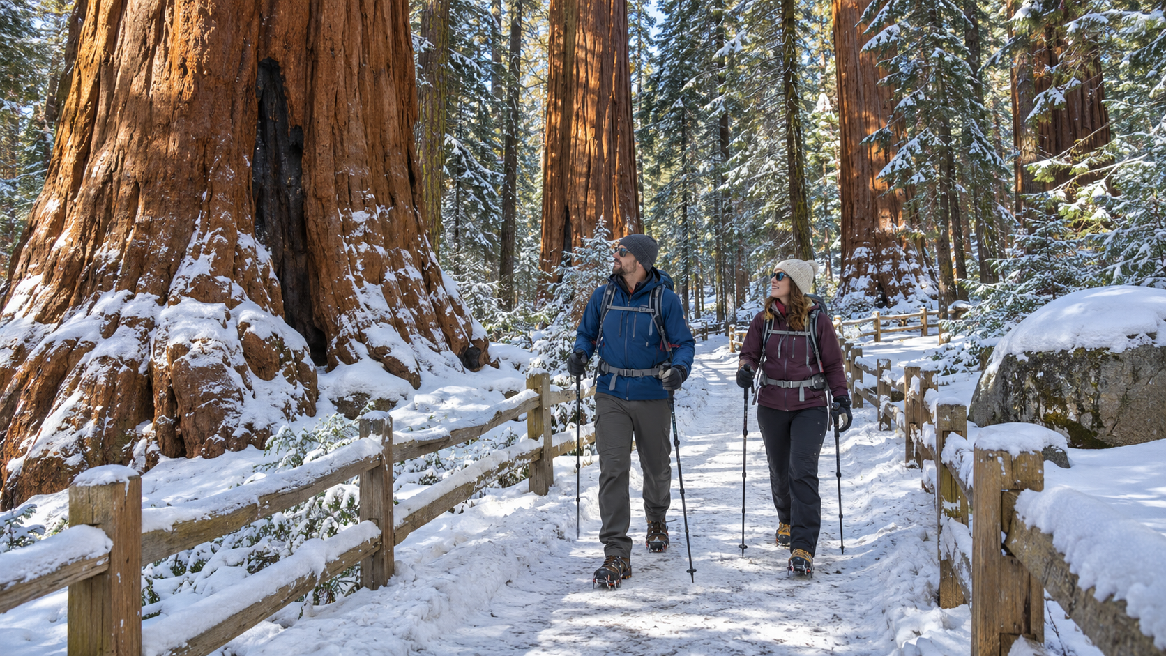
Two prepared hikers use poles and footwear traction on a snowy trail among giant sequoias in Mariposa Grove.
The free Mariposa Grove shuttle is weather-dependent. The published 2026 schedule lists service from November 1 through November 30, weather permitting, from 8 a.m. to 3:30 p.m., with the last bus leaving the grove at 5 p.m. The road and shuttle can close before November 30 if conditions require it, so confirm service before driving to the welcome plaza.
From December 1 through at least April 15, there is no shuttle. When the road is closed, visitors reach the grove by hiking the Washburn Trail or walking the Mariposa Grove Road. Either approach is about two miles each way with roughly 500 feet of elevation gain before the additional trails inside the grove. Snow and ice can turn that into a more demanding outing than the mileage suggests.
Treat the grove as a winter hike, not as a short bus stop. Carry layers, water, food, a headlamp, navigation, poles and traction suited to the current surface. Snowshoes or skis may be appropriate after deeper snowfall. Start early enough to return before dark, and do not walk on a closed roadway unless the park says pedestrian use is allowed.
Footwear traction can help, but match it to the route
For packed snow and icy trails, footwear traction can be useful when rangers recommend it. One verified example is the Kahtoola MICROspikes in black, size medium, ASIN B07MNTQRN1. Kahtoola describes the current MICROspikes design as a hiking-oriented traction device with 12 stainless-steel spikes per foot. The linked ASIN is specifically the black medium variant; confirm the live listing, size chart, seller, return terms and product identity before purchase.
Traction devices are not a substitute for tire chains, snowshoes, mountaineering crampons, route-finding skills or judgment. A spike that grips hard ice may ball up in soft snow, and aggressive metal points can be awkward on bare rock. Ask a ranger which equipment fits the intended trail and conditions, and practice putting the device on over the actual boot before the trip.
Affiliate disclosure: ReaderSpice may earn a commission from qualifying Amazon purchases made through this link, at no additional cost to you.
Where to stay and when crowds return
Winter services are limited outside Yosemite Valley, so a low room rate does not make an inconvenient route practical. Confirm that the lodging is inside the park or identify the entrance and driving time it uses. A property described as being near Yosemite may still be a long winter drive away, especially if Tioga Road is closed or a storm adds chain controls.
The park’s winter FAQ lists Upper Pines, Camp 4, Hodgdon Meadow and Wawona as the campgrounds that remain open in winter, but operating dates, reservation rules and water availability can change. Check Recreation.gov and the park camping page for the exact night. Winter camping requires a plan for freezing temperatures, wet gear, food storage and safe heating; never use a stove or fuel-burning heater inside a tent or enclosed vehicle.
Late December and early January can be busy, and the Horsetail Fall viewing period in February may trigger special traffic management or entry reservations depending on the year. Do not assume a weekday in winter will always mean empty roads. Reserve lodging early for holidays and verify the current Horsetail Fall plan before building a February itinerary.
A 48-hour Yosemite winter checklist
- Open the National Park Service current-conditions page and confirm every road needed for the itinerary, including the chosen entrance and the return route.
- Call 209-372-0200, press 1 then 1, for the latest in-park road recording; compare outside highways with Caltrans QuickMap.
- Check the National Weather Service forecast for Yosemite Valley and any higher destination rather than using only a city forecast.
- Confirm chains match the tire size, practice installation and pack gloves, a light and a kneeling pad.
- Verify lodging, campground, shuttle and activity reservations, plus check-in deadlines and cancellation rules.
- Download maps, booking confirmations and emergency contacts for offline access; tell someone outside the trip the route and return time.
- Pack layers, waterproof footwear, food, water, traction and a headlamp for the exact activity; shorten the plan if the group lacks winter experience.
- Recheck alerts on the morning of travel. If the official status conflicts with a navigation app, follow the official closure and chain-control information.
The bottom line
Yosemite remains visitable in winter, but the reliable version of the trip centers on Yosemite Valley, Wawona and western access rather than a summer-style drive across the Sierra. Tioga and Glacier Point Roads were temporarily closed after a November 12 snow forecast, and their status may change before the normal seasonal closure becomes clear. Treat every date and route as conditional until the same-day check.
Carry chains, choose the entrance that fits the forecast, budget the long detour when Tioga Road is closed, and treat Mariposa Grove as a winter hike after shuttle service ends. The reward is a quieter park and a different landscape, but only if the itinerary leaves room for weather, darkness and a safe decision to turn around.
Sources
National Park Service: Yosemite current conditions and November 12, 2026 road alert
National Park Service: Visiting Yosemite in winter
National Park Service: Yosemite winter frequently asked questions
National Park Service: Winter driving, chain controls and road-condition numbers
National Park Service: Yosemite winter road closures and detour estimates
National Park Service: Mariposa Grove access and 2026 shuttle hours
Kahtoola: MICROspikes footwear traction specifications and sizing
Outdoors Magazine: MICROspikes black medium identity and ASIN verification
Amazon: Kahtoola MICROspikes black medium, ASIN B07MNTQRN1 (affiliate link)
Inline image 1: Winter tire-chain preparation near Yosemite. Alt text: Two prepared travelers install tire chains at a designated pullout beside a snowy mountain road near Yosemite.
Inline image 2: Winter hiking in Mariposa Grove. Alt text: Two prepared hikers use poles and footwear traction on a snowy trail among giant sequoias in Mariposa Grove.